Prime Location in a World-Class District: Located within one of the most prospective titanium districts globally.
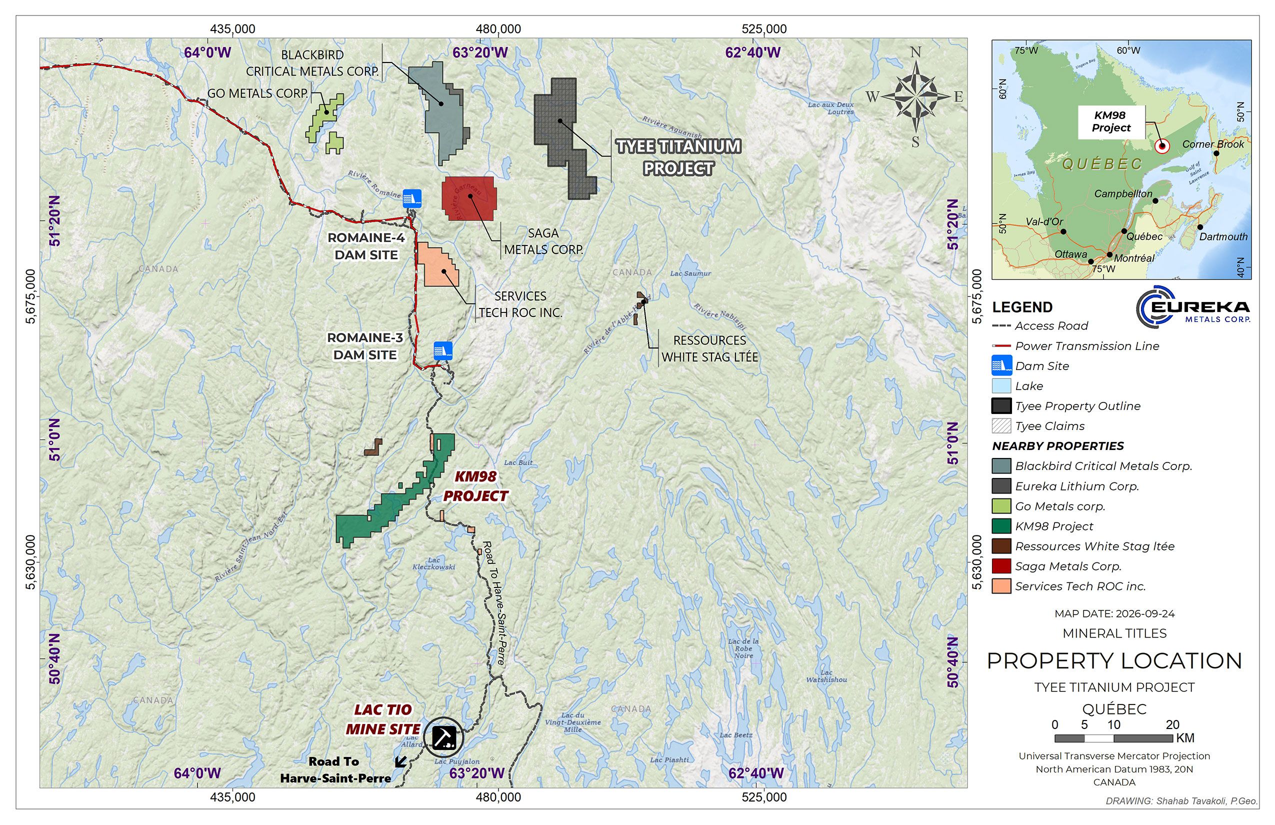
Geology: Mineralization at the KM98 Property is analogous to the world-class Lac Tio Mine owned by Rio Tinto.
Advanced Exploration Stage Project: The Project is drill-ready & benefits from substantial prior exploration.
Strong Regional Infrastructure: The surrounding titanium value chain has seen $733 million committed by Rio Tinto to its operations in the region by 2030[1], alongside completion of a $7 billion hydroelectric facility less than 10 km from the Project.[2]
Proximity: Located just 45 kilometers north of the Lac Tio mine, the largest hard rock titanium ore mine in Canada, which produces approximately 3 MT of ore annually.[3]
Recent Exploration: Recent work has included geophysics, mechanical stripping and channel sampling, with 39 samples submitted for laboratory analysis.
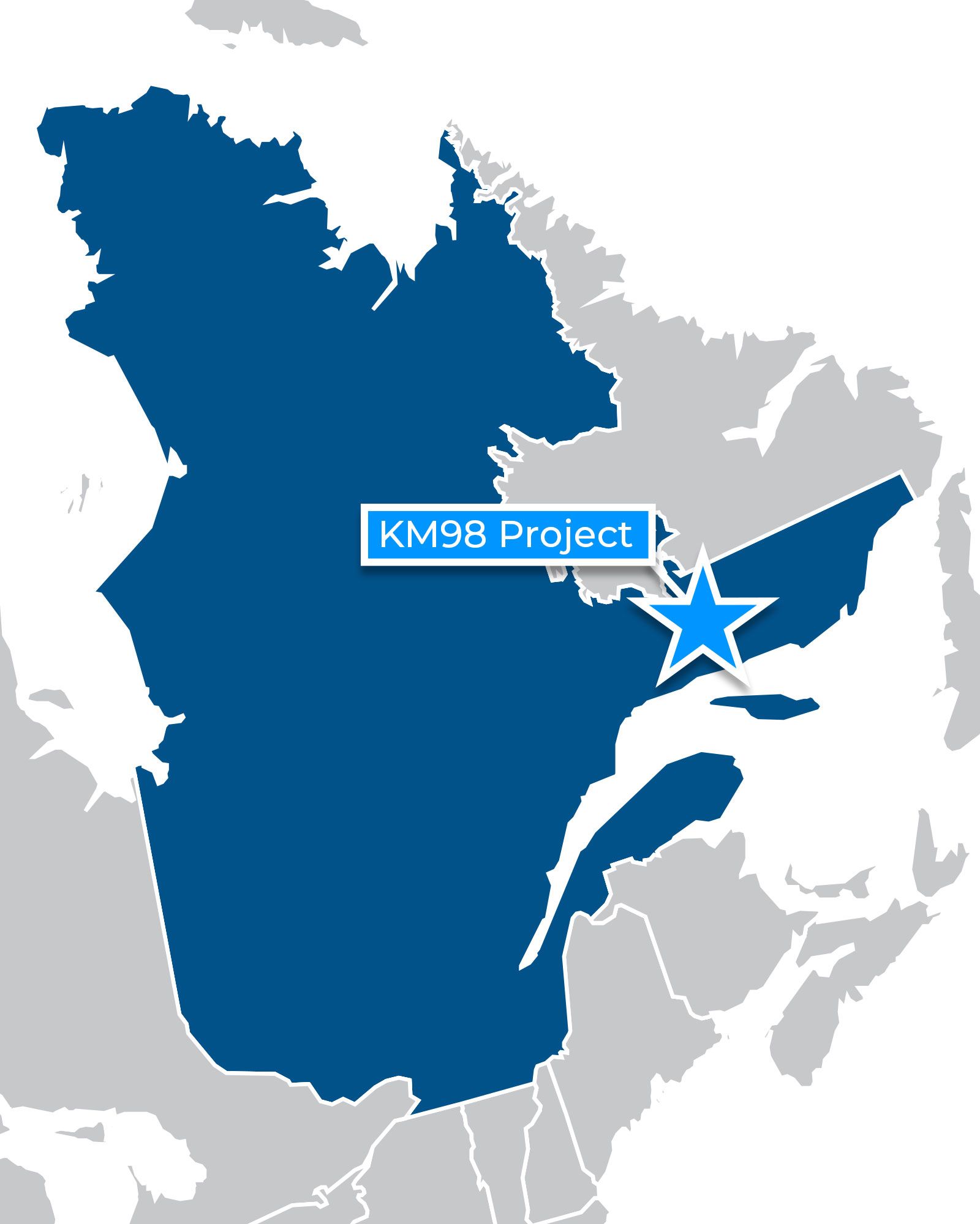
The KM98 Project is located approximately 60 km north of Havre-Saint-Pierre, Québec, within the Havre-Saint-Pierre Anorthosite Complex. The Project hosts multiple titanium-iron-vanadium exploration targets associated with oxide mineralization identified through historical exploration, airborne geophysics and surface sampling.
Eureka holds an option to acquire an interest in the KM98 Project pursuant to the terms previously disclosed by the Company.
District-scale 82.5 km2, titanium-focused land package located within the Havre-St-Pierre Anorthosite Complex.
One of the most prospective and infrastructure-advantaged titanium districts globally.
Drill-Ready Exploration Targets: KM98 hosts massive and semi-massive oxide mineralization at surface together with large geophysical targets. Existing permits are in place for diamond drilling at the Hook and Roadside targets.
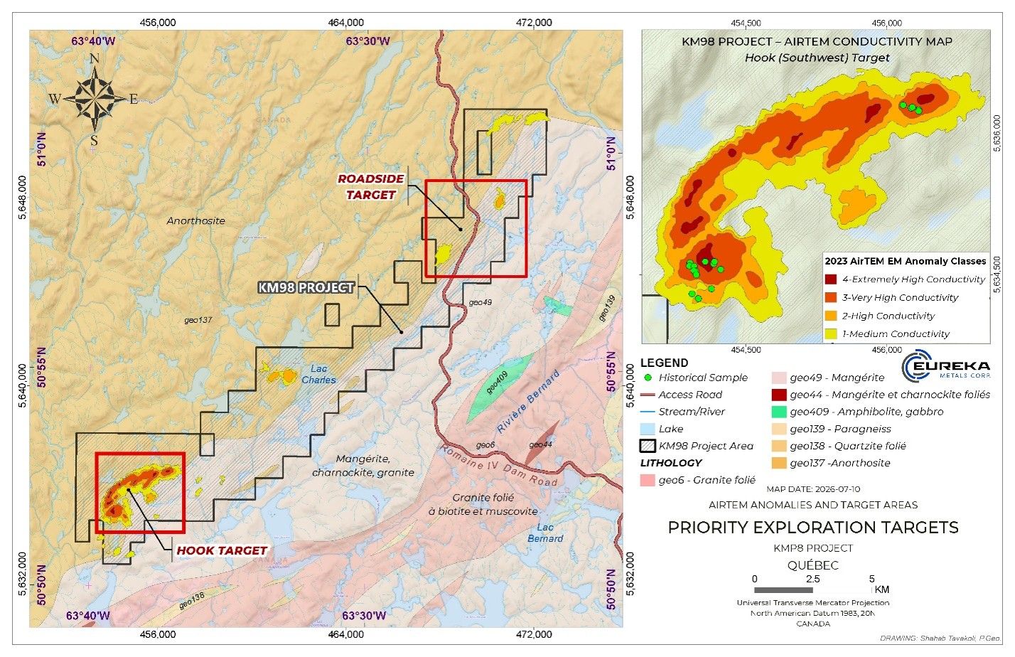
Two Advanced Exploration Targets: The KM98 Project includes two priority exploration targets; the Roadside, and Hook targets. Hook is the principal drill target, with surface mineralization and large geophysical targets, while Roadside has been advanced through metallurgical work and recent stripping and channel sampling.
Click to Enlarge
Mineralization hosted on adjacent or nearby properties is not necessarily indicative of mineralization on the Company’s property. Qualified Person. The scientific and technical information contained has been reviewed and approved by Ryan Versloot, P.Geo., a technical advisor to the Company and a Qualified Person as defined under National Instrument 43-101. The Company has not independently verified all historical exploration data generated by previous operators.
KM98 HOOK TARGET
Highlights:
High-grade titanium mineralization at surface: Sampling at the North area returned up to 28.50% TiO₂, 66.31% Fe₂O₃ and 2,085 ppm vanadium from massive oxide mineralization.
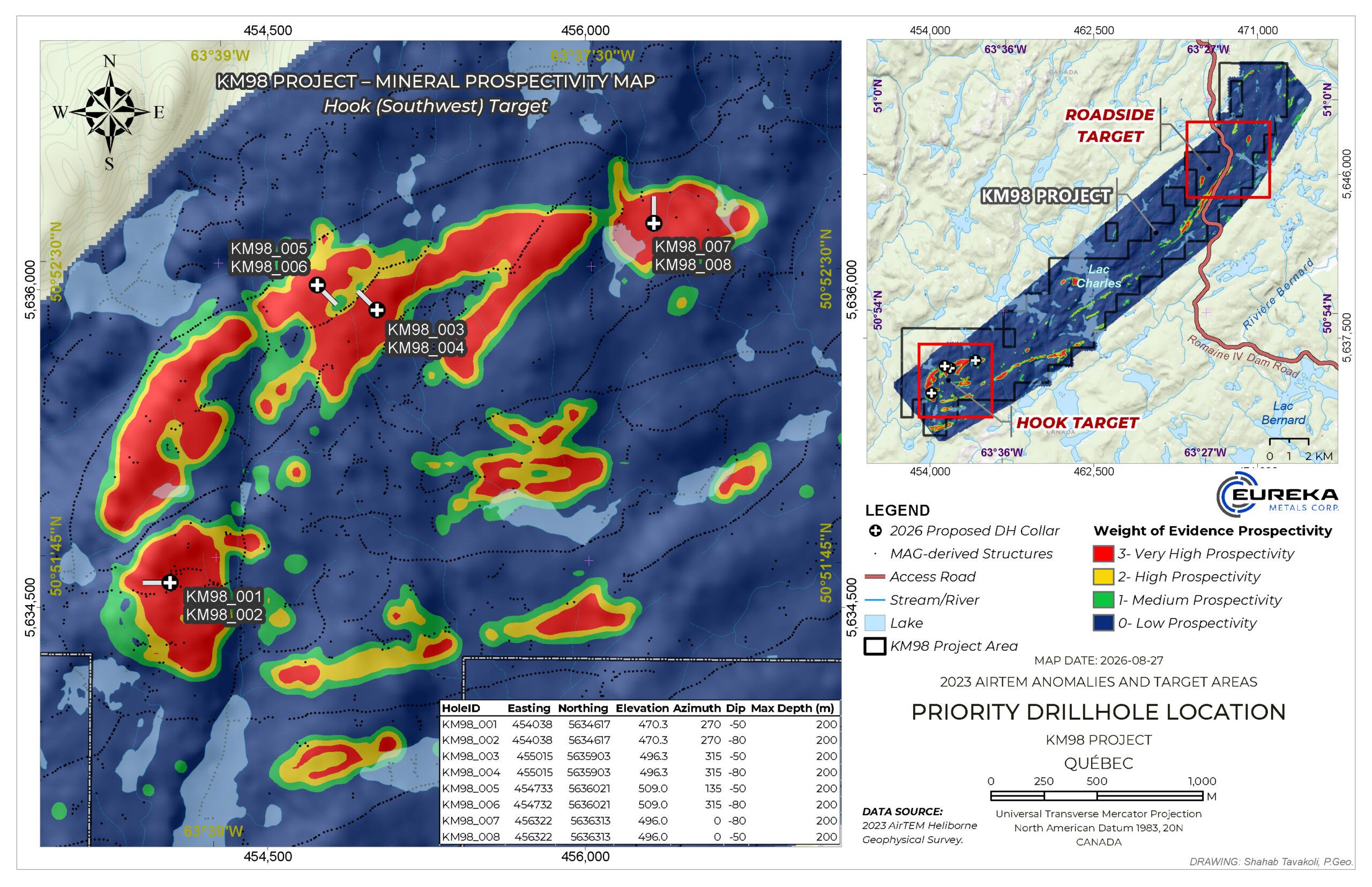
Drilling to test an approximately 5 km prospective trend: The Hook Target combines titanium-bearing massive and semi-massive oxide mineralization at surface with large geophysical targets beneath and between the known occurrences.
Large, untested Center target: 3D magnetic inversion modelling indicates a sizeable magnetic body between the mineralized North and South areas, extending from near surface to depth and not previously tested by drilling.
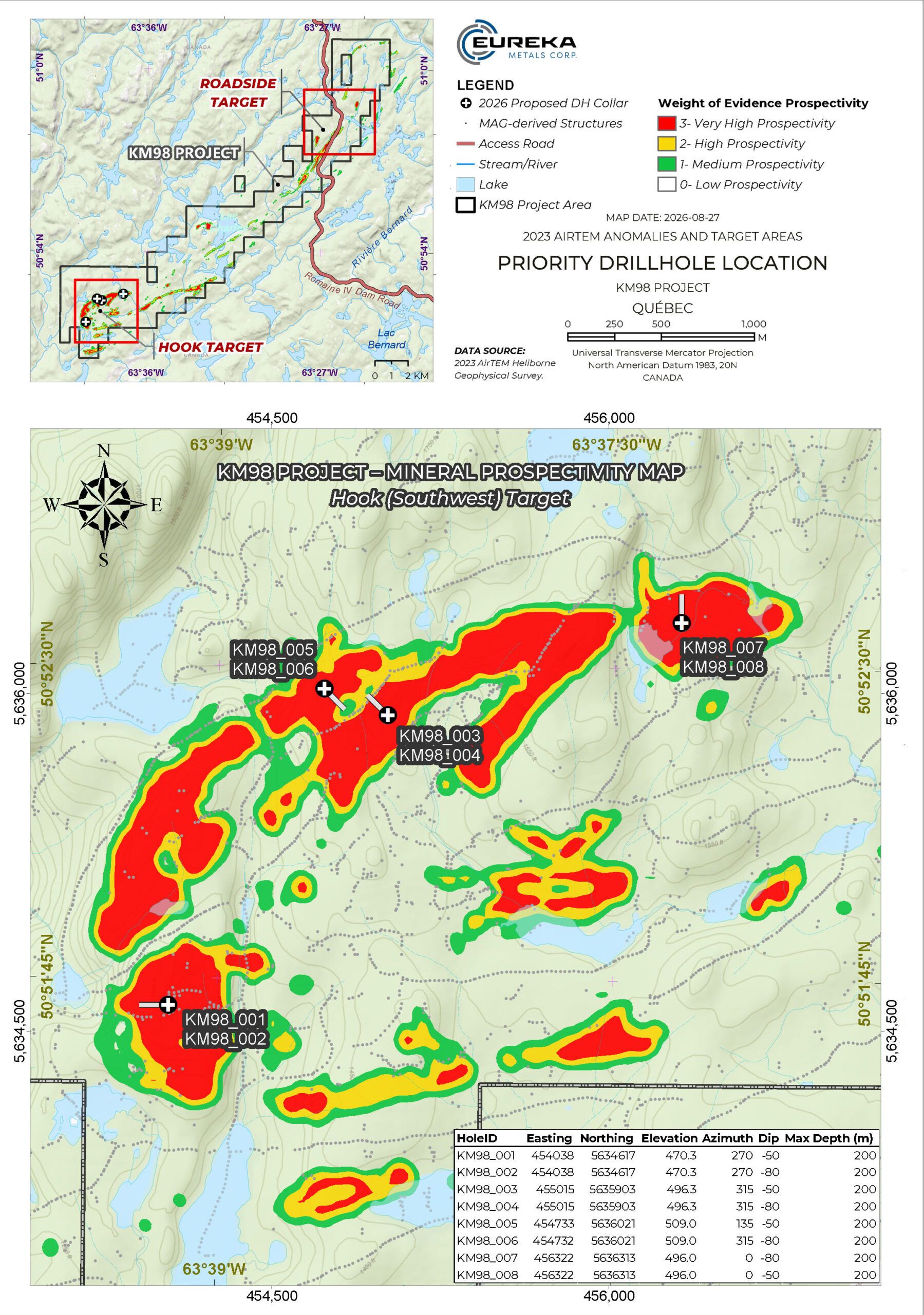
Eight-hole initial drill program planned: across the North, Center and South areas. Holes are planned to maximum depths of approximately 200 metres and will test both known surface mineralization and targets identified through geophysics.
First subsurface test of Hook: Drilling will begin testing the potential scale and geometry of oxide mineralization beneath the Hook Target and provide information to refine future drilling.
Click to Enlarge
Click to Enlarge
Prospecting at Hook in 2024 identified titanium-bearing massive and semi-massive oxide mineralization at the North and South areas. At North, a grab sample of massive oxide containing greater than 65% visually estimated mineralization returned 28.50% TiO₂, 66.31% Fe₂O₃ and 2,085 ppm vanadium.
Airborne geophysical data and subsequent 3D magnetic inversion modelling indicate substantially larger targets beneath and between the known surface occurrences. In particular, the Center area contains a sizeable magnetic target extending from near surface to depth. Center has no surface assay results or bedrock observations and has never been drill tested.
The initial drilling will test beneath known surface mineralization as well as the Center target to begin determining how the mineralization observed at surface relates to the larger geophysical footprint at depth.
Click to Enlarge
Hook Target Initial Drill Program
The current drill plan consists of eight proposed holes from four approved drill sites across the South, Center and North areas. Individual holes are planned to maximum depths of approximately 200 m.
Initial drilling is planned in areas where titanium-bearing massive and semi-massive oxide mineralization has been identified at surface before progressing to the untested Center target. The program is designed to test whether the large geophysical targets correspond to massive oxide bodies at depth and, where mineralization is encountered, begin defining their thickness, orientation and composition.
Drill targeting is being refined using the Project’s magnetic and electromagnetic geophysical datasets. Magnetic susceptibility and conductivity measurements are also planned on drill core to correlate the geology encountered in drilling with the airborne geophysical responses and assist in refining future drill targets.
Final hole depths, orientations, sequencing and total metres completed may be adjusted based on geological observations, drilling performance and the available operating window.
KM98 ROADSIDE TARGET
Highlights:
Mechanical stripping completed in September 2026 at the Roadside Target.
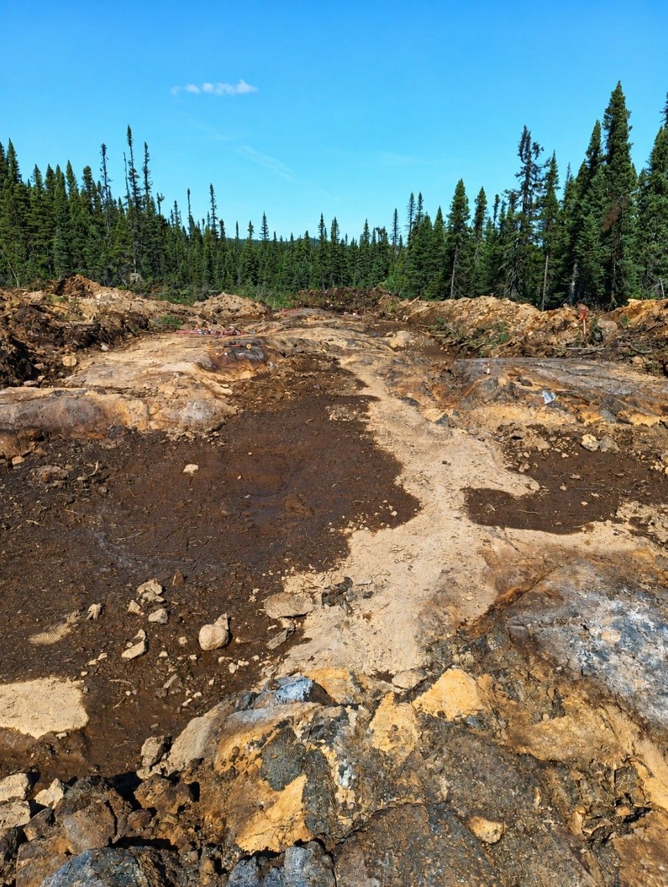
Work exposed a zone of massive oxide mineralization, with a western extension also excavated to investigate the surrounding geology.
Geological examination and systematic channel sampling were completed across the exposed oxide-rich zone.
39 samples were collected, including a seven-metre sampling interval.
Samples have been submitted for laboratory analysis.
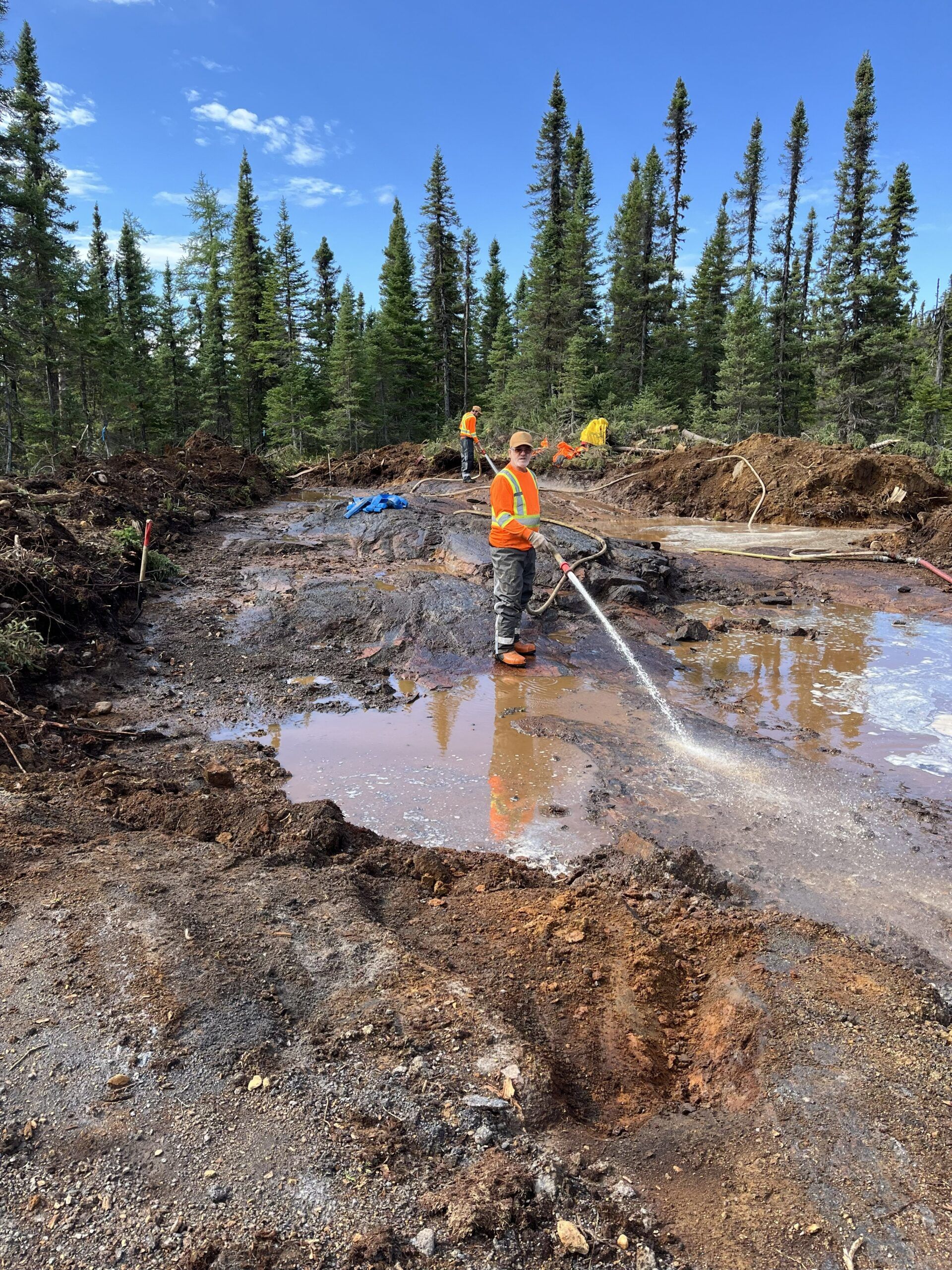
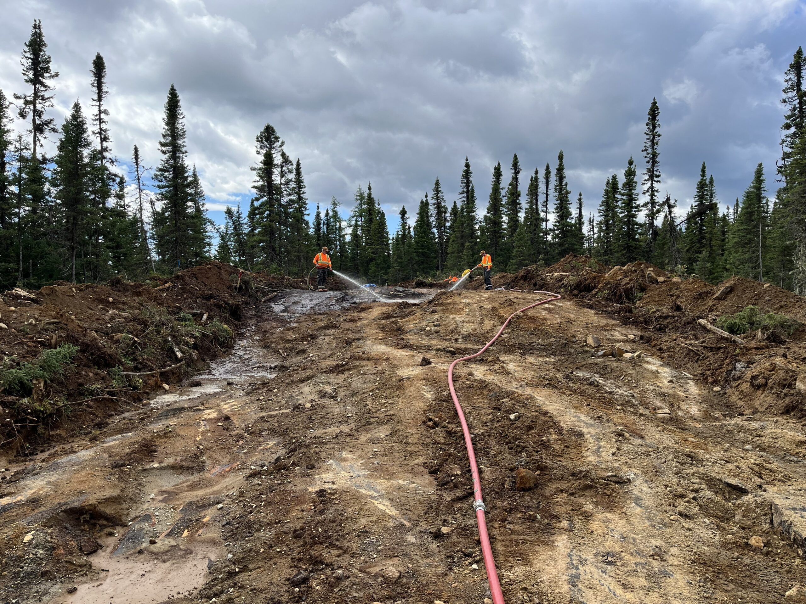
Roadside Target Stripping Click to Enlarge
Stripped bedrock exposure at the KM98 Roadside Target, where massive oxide mineralization was identified. Click to Enlarge
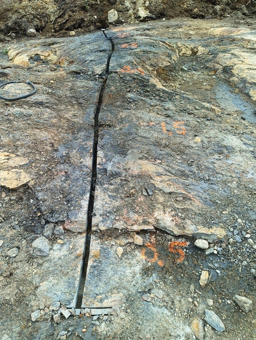
Channel sampling across exposed bedrock at the KM98 Roadside Target. The channel measures approximately 7.5 metres in length. Click to Enlarge
The Roadside Target is located along a prominent magnetic trend with direct access from the Romaine IV government service road. Historical exploration identified massive and semi-massive oxide mineralization at surface within the Roadside area.
In 2025, ten large surface samples, each weighing approximately 10 to 15 kg, were collected from outcrop and subcrop along approximately 240 m of the Roadside area. These samples were subsequently used in bench-scale metallurgical testing conducted by IOS.
Roadside Target 2026 Exploration Program
In September 2026, Eureka completed mechanical stripping, geological examination and systematic channel sampling at the Roadside Target. The program exposed a zone of massive oxide mineralization, with additional excavation completed to investigate a western extension.
A total of 39 samples were collected, including a seven-metre channel sampling interval. Samples have been submitted for laboratory analysis.
Historical Metallurgical Test Work
Historical bench-scale metallurgical testing by Go Metals on Roadside material produced separate magnetite and ilmenite concentrates using magnetic and gravity separation. The historical test work reported an iron concentrate grading up to 68.5% Fe with associated vanadium values and an ilmenite concentrate grading up to 48.4% TiO₂.
Roadside Target Stripping. Click to Enlarge
Surface exposure at the Roadside Target, KM98 Titanium Project, Québec